Wednesday, July 17, 2024

A Boat of My Own


A Boat of My Own

by Amy Brunvand

I’ve been rowing rivers for 30+ years, but until last year I never owned my own raft.  The University of Utah where I work has an outdoor rental shop and it seemed easier to let someone else store and maintain the gear.  But then my two kids went off to college and I turned into a sixty-something empty nester.  When Jack’s Plastic Welding offered a sale price on my dream boat I thought, it’s now or never, and placed an order for a bright red Cutthroat II Cataraft.   It’s small enough so that I can move and assemble the parts by myself but large enough to carry group gear for a week.

If you look at rafting videos on the Internet (which are like cat videos for river runners), you’ll notice that there are almost no older women.  There are young bros, and grizzled old men and river babes in colorful skirts and sarongs, but nobody who could be a grandmother.   It's true out on the river, too.  There are a few women raft guides, but in private groups nearly all the rowers are men.  Why?  I have some theories, but fundamentally I think it’s because men own the boats, so they tend to manage the oars.

For the past 13 years I’ve done at least one river trip annually with a group of families. Our daughters are all the same age.  Last summer we ran the main Salmon River in Idaho, and the girls (now 18-19) took charge of one of the rental rafts to row themselves down all 80 miles.  I rode along in order to coach them through some of the larger rapids, but I never had to take the oars.   Even though I love to row, it was genuinely a peak experience to see how over the years our little river girls have grown up and developed the skills and knowledge to row their own raft.

This summer I got another chance to run the main Salmon, this time rowing my own new boat.  I’d had the Cutthroat out on some mild rivers, but not yet on anything above class II rapids. Before we went, I joked that I would find out if I can really row as well as I think I can. Honestly, I was a little worried. On the first big rapid, a wave knocked me off the rowing seat, but I held onto the oars and kept rowing.  I soon realized that even if waves were pushing the boat around more than I was used to, I could stay with it.  By the end of the trip, I felt connected to the soul of the boat. At one stop we were chatting with another rafting party and a woman commented, “I love your boat”.   “I love it too,” I said.


Saturday, July 13, 2024

Backpacking in the Needles District of Canyonlands National Park

A Broads View of Backpacking in the Needles District of Canyonlands National Park

By Amy Brunvand

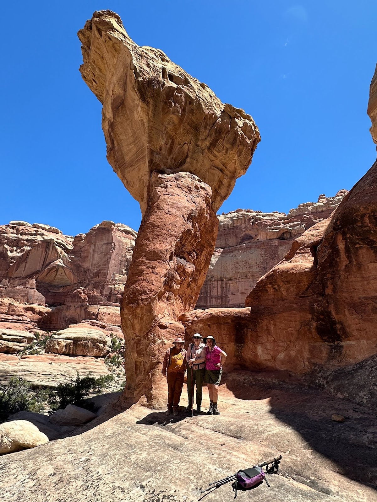
Salt Creek Backpack, May 14-19, 2024, Cathedral Butte to Needles Campground, 27.4 miles backpacking + side hikes to Angel Arch and various archeological sites.

Amy Brunvand + Dana, Karen, Charley and Celina

For three years I had been trying to line up the right permits for a backpack trip down Salt Creek in Canyonlands National Park. There are only a few reservable backcountry sites, so in order to thru-hike you have to get them in the right order at a time of year that’s not too hot, too buggy or too dark. The stars finally aligned for a five-night trip in May.  I persuaded my sisters Dana and Karen, my daughter Charley and her friend Celina to come with me for what I promised would be an epic adventure.  Coyote Shuttles in Moab dropped us off at the trailhead. “You know you have to walk all the way back to your car,” the driver joked.

Despite the name, Salt Creek is not actually salty.  It’s a year-round freshwater creek making it a rare desert hike where you don’t have to carry tons of water.  It’s also a huge success story for environmental activism. Back in the 1990s, San Juan County tried to claim Salt Creek as an RS2477 highway.*  Off-road vehicles drove in the water on their way to Angel Arch, churning up silt and thrashing through willows. When the National Park Service tried to limit the number of vehicles, San Juan County sued. The Southern Utah Wilderness Alliance (SUWA) sued back. After more than 16 years of back-and-forth litigation, the courts decided that the park service could close the road permanently to protect the riparian habitat. Jeeps have been gone from Salt Creek for 20 something years now and the water is full of aquatic life.

It wasn’t Charley’s first time backpacking in Salt Creek.  Twenty-one years ago before she could even walk I carried her on a 5 night trip during one of the lulls in off-road traffic.  At the time I was volunteering for SUWA on a project to document the condition of RS2477 road claims so I wanted to see Salt Creek by foot in order to know what we were trying to save.  On that trip we hiked to both Angel Arch and the famous All American Man pictograph, but grown-up Charley couldn’t remember a thing except for a story I told about how baby Charley took off her hat and gleefully threw it over a cliff.

This trip started with a steep descent from Cathedral Butte to our first campsite at #SC2 is located near an old cabin and a spring where ancient people left painted handprints on the rock wall. Dana had not been backpacking for years.  She had an outdated 1980s backpack that seemed much too big for her.  Luckily it proved to be adjustable or she would have been truly miserable.  All of our meals were crammed into mandatory bear jars.  The ranger told us that little desert bears come down from the Abajo mountains to Salt Creek in order to eat prickly pear cactus. The bear jars limited how much food we could cram in, so we had mostly freeze-dried backpacking meals. They taste a lot better if you perk them up with extra cashews, chicken pouches, dried cranberries and such.  We saw a little bit of bear scat, but no bears


Tuesday, May 28, 2024

Celebrating Wilderness From North to South

Hiking From North to South

Photo by Lotti Wann

To date, participants in the hiking/paddling challenge have visited the Bonneville Shoreline Trail (BST), trails around Snowbasin, Kanab, Canyonlands and Pineview. Great start! Join us anytime for this fun challenge and qualify to win some prizes along the way. We are celebrating 60 years of the Wilderness Act, but you don't have to be IN wilderness to appreciate why we need it. 

If you need additional motivation, here’s a link to the Trails Foundation of Northern Utah (TFNU) peak challenge for 2024. It kicks of on Saturday, June 1, which is also National Trails Day. Peak Challenge — TFNU

Wednesday, May 8, 2024

Is It May or March

 Is it May or March - Hard to Tell by Looking at the Mountains

Snowbasin from the old road, May 8, 2024

The 2024 Broads Hiking/Paddle Challenge has kicked off with a mix of sprinter (Spring/Winter) weather. You have to be creative this time of year to avoid wet and snow-covered trails. Some of us have gone south (Kanab is one of the favored locations) and others find routes where you can keep your boots dry. 


Everyone, let's get hiking.

Monday, May 6, 2024

Hike - Paddle and Celebrate 60 Years of Wilderness


Calling All Hikers and Paddlers - Help Celebrate 60 Years of Wilderness Protection

Join the fun as Great Old Broads for Wilderness celebrates 35 years protecting wild places and 60 years of wilderness protection. Hike or paddle 60 miles by the September 3, Wilderness Act anniversary and win great prizes along the way. It’s easy to participate. Send your name and email to bmcconvill@gmail.com and you will be registered. Every time you take a hike or paddle a stream, log your miles and send our way (include a photo if you like). We will keep track of everyone's’ progress and award prizes at the following milestones:

  • 15 miles gets you some cool stickers and a sticker book

  • 35 miles and your reward is a Chico Chica reusable bag

  • 45 miles and you are rewarded with To-Go-Broads ware

  • 60 miles by September 3, a certificate of achievement suitable for framing plus a bag of goodies

The Wilderness Act of 1964 established the National Wilderness Preservation System,
a national network of more than 800 federally designated wilderness areas.
These wilderness areas are managed by the National Park Service, Bureau of Land
Management, US Fish and Wildlife Service, and US Forest Service. You don't have to be in a
designated wilderness to appreciate wild land qualities. Public lands wherever you might find
them offer refuge for wildlife and a place to seek connection, inspiration, sustenance, adventure, and more for each of us. Join the challenge today. 


Friday, June 30, 2023

 EXPLORING WASATCH WILDERNESS

PART TWO OF A TEN PART SERIES
MOUNT OLYMPUS WILDERNESS AREA
(Source: USFS)The Mount Olympus Wilderness was established by Congress in 1984 with the passage of the Utah Wilderness Act. Located within the central Wasatch range, the area consists of approximately 15,856 acres and is generally bounded on the north by Mill Creek Canyon, on the south by Big Cottonwood Canyon, on the west by the Salt Lake Valley, and on the east by Gobbler's Knob, Alexander Basin, and Dog Lake. The portion in Big Cottonwood Canyon falls under Salt Lake City watershed restrictions.
There are several entry points in each canyon and along the Front as well. They include the following: Mount Olympus Trail and Neff's Canyon from the benches along the front; Thayne's Canyon, Porter Fork (private road), Bowman Fork, and Alexander Basin on the northern or Mill Creek Canyon side; and Mill B North Fork and Butler Fork on the south side from Big Cottonwood Canyon. You can also enter the Wilderness about a quarter of a mile west of Dog Lake.

The Dog Lake entry receives most of the mountain bicycle violations. Bicyclist like to ride the Desolation Trail to the Mill A Basin Trail and out or exit the forest by way of Butler Fork. You will also see a little less use here in general except for the increasing problem with mountain bikes (mountain bikes are not allowed in wilderness areas).

The Mount Olympus Wilderness provides a spectacular backdrop for the Salt Lake Valley and is dominated by rugged terrain, narrow canyons, and high peaks, including Mount Olympus, Mount Raymond, and Gobbler's Knob. Much of the higher elevation is alpine, characterized by large, open cirque basins, and exposed rocky ridges.  Snow remains in some areas until mid-summer.

Broads let's help educate the public! To preserve and protect the physical and aesthetic environment, National Forest wilderness areas are closed to motor vehicles, mechanized equipment, hang gliders, and bicycles. 

Full disclosure - we are not wilderness experts! Part of our mission as volunteer GOBFW leaders is to educate ourselves and others about wilderness, wild places and public lands. Our 2023 theme is Walking the Wilderness and we encourage all Broads and Bros to get to know your Utah (and especially Wasatch Front and Back) wilderness areas better. The more educated we are about these wild places, the better prepared we will be to rally against wilderness mistreatment.  Many of us are probably not going to hoist our ancient, heavy backpack onto our broken and creaky backs anymore, but we can get a peak at these special places and learn more about their unique features.

Sunday, June 18, 2023

WALKING THE WILDERNESS - PART I

 EXPLORING WASATCH WILDERNESS - PART ONE OF A TEN PART SERIES

Full disclosure - we are not wilderness experts! Part of our mission as volunteer GOBFW leaders is to educate ourselves and others about wilderness, wild places and public lands. Our 2023 theme is Walking the Wilderness and we encourage all Broads and Bros to get to know your Utah (and especially Wasatch Front and Back) wilderness areas better. The more educated we are about these wild places, the better prepared we will be to rally against wilderness mistreatment.  Many of us are probably not going to hoist our ancient, heavy backpack onto our broken and creaky backs anymore, but we can get a peak at these special places and learn more about their unique features.

MOUNT NEBO WILDERNESS AREA


The Mt. Nebo Scenic Byway (located between Payson and Nephi) is the primary access to Mount Nebo Wilderness Area, which was designated by the United States Congress in 1984. The wilderness area encompasses 28,022 acres and is managed by the U.S. Forest Service. The centerpiece of the southern portion of the wilderness is Mount Nebo, which looms above the wilderness area between Interstate 15 on the west side of the area, and the Byway to the east. Wilderness elevation begins at approximately 5,400 feet elevation, climbing through mountain valleys and meadows broken by moderate to steep ridges. The Wilderness Area encompasses four USFS maintained trails, totaling approximately 21 miles within the wilderness area. The trail system provides access to sites and is linked with other trails that border the wilderness area.

Twenty-seven trails are located along the Byway, seven of which lead into the Mount Nebo Wilderness Area. Mount Nebo is the highest peak of the Wasatch Mountain range. The mountain is crowned by three peaks, with the northern peak reaching 11,928 feet . Parts of the mountain are covered in snow from mid-October until July and it is a popular, although strenuous, destination for hikers and equestrians.

The extensive winter snow melt caused damage along the Byway as well as Santaquin Canyon Road. Make sure to check road conditions before exploring the area. Some areas are expected to open by June 16, others not until the end of July.

Sources: Nebo Loop Scenic Byway Corridor Management Plan Update, Wilderness Connect, USFS Spanish Fork District

Friday, April 14, 2023

 ANTELOPE ISLAND HIKE

Beautiful day, fun friends, great conversation

 WE TOUCHED OUR FIRST WILDERNESS OF 2023

Our Broadband theme for 2023 is Walking the Wilderness and our intent is to become better educated about the wilderness we are passionate about protecting. According to the USFS description, "the Mount Olympus Wilderness was established by Congress in 1984 with the passage of the Utah Wilderness Act. Located within the central Wasatch range, the Mount Olympus Wilderness consists of approximately 15,856 acres and is generally bounded on the north by Mill Creek Canyon, on the south by Big Cottonwood Canyon, on the west by the Salt Lake Valley, and on the east by Gobbler's Knob, Alexander Basin, and Dog Lake. The portion in Big Cottonwood Canyon falls under Salt Lake City watershed restrictions."

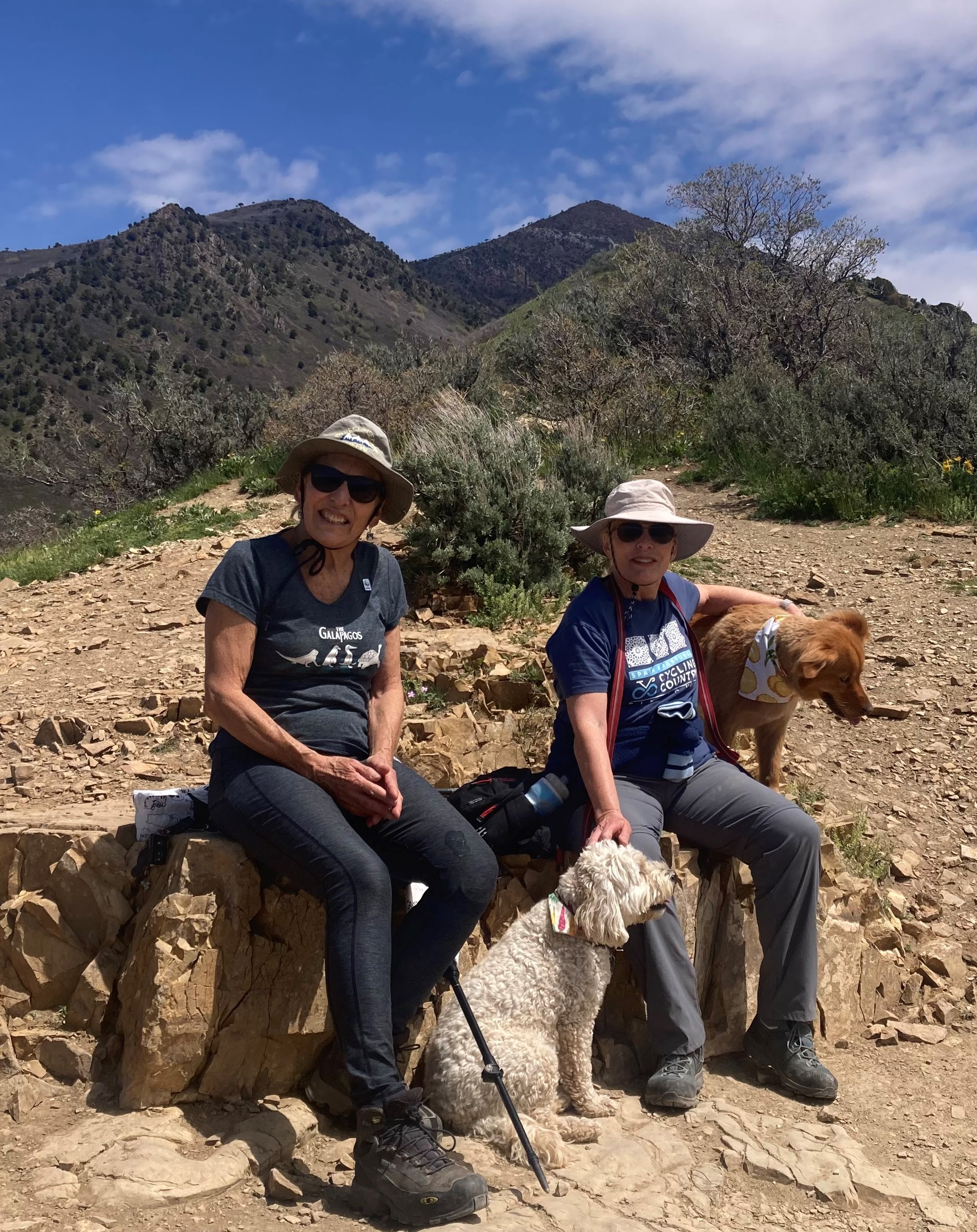
On February 15, seven Broads and Bros and one dog, wandered 4.25 miles up the Burch Creek trail and back around to Millcreek. On occasion the clouds parted and we were able to see a stunning view of the surrounding peaks. The day was crispy cool, but the company warm. We were honored to have the leader of the new Broadband in Flagstaff, Cuyler, and her husband Tom, along for the outing.  

Tuesday, August 23, 2022

 Best Laid Plans……


Three-hundred ninety miles and feeling great! Back issues resolved with Barnacle the tennis ball, heel blisters no longer a problem, strong mind, strong body and then the knee pain began. Mild at first, then searing. SAVED was midway through segment 23 from Carson Saddle to Stony Pass. She had done some big pushes the day before the pain started. A rest overnight was not helpful, and she awoke in the morning with big time swelling and stiffness.

The first few morning miles were painful. Her hiking mates took some of her weight. It was only getting worse. One of the hardest decisions a thru-hiker must make is when to stop. A quick look at the GPS showed a way off the trail at mile 10.6. It was a four-mile dirt road that joined the Alpine Loop about four miles from Silverton.

SAVED texted her resupply team. When we received the distress call, we were eating lunch at the top of Wolf Creek Pass near Pagosa Springs after breaking camp that morning near Creede. “I am having some major knee issues. I’m going to need to bailout on a dirt road coming up.” We were three hours away! Many thoughts raced through our hearts and minds, but we keep our cool, found her approximate location on the map and headed toward Silverton where we were scheduled to camp that evening.

She found the dirt road that was void of traffic and limped the four miles to the loop road. It was the slowest hiking she has ever done she reported later. At the loop, a couple with a dog offered her a ride apologizing for the dog who was now resting on her lap in the back seat. Little did they know how healing that was for her. Timing was perfect as we were checking in at the Silverton Lakes RV Park when she arrived.

Little was said that evening about the end of her journey. She showered, loved on Tallus and we had a nice meal in town. Ice and elevation helped and by next morning she saw some improvement but was still stiff and swollen. She plans to stick around and welcome her hiking buddies, Pages and Breaker, when they finish in Durango in a few days.

It appears her injury is due to overuse and will hopefully recover in time for her to return to where she ended her journey and finish the final five and a half segments this fall. If not, she will be back next year to complete her journey. Bravo for the nearly 400 miles hiked, the new friendships formed, and the incredible strength gained from this experience. We love you Colleen, Coco, Cocoleeno, SAVED. You certainly SAVED yourself!

TRAIL NOTES: The best laid plans, a proverbial expression used to signify the futility of making detailed plans when the ability to fully, or even partially, execute them is uncertain, might best describe this situation.

 Rain, Rain Go Away!

Three-hundred fifty miles and counting as SAVED completed segments 18-21 on August 16 and was greeted by her dad at Spring Creek Pass, 17 miles from Lake City. After three hours of rain, and many miles across the sheep filled Snow Mesa she and her hiking companions Pages and Breaker were ready for warm, dry clothes, a hot shower, hearty food, and a soft bed. They booked a quiet hotel in Creede and Mike gave all three a ride down the mountain.

Creede is a historic mining town that now claims it’s riches from the many tourists who visit both summer and winter. Countless miles of 4-wheel drive roads radiate from the town center. The Rio Grande snakes its way through the lowlands and the scenic drive from Creede to Lake City (the Silver Thread) provides a sampling of Colorado’s best vistas and valleys.

Drying wet gear is one of the challenges for thru hikers. A little cooperation from Mother Nature helps, and she came through for them on Wednesday morning. Tents, sleeping pads, bags, and ground covers all got a good drying, the rest of the soaked clothing went to the laundromat across from the hotel. Good thing they started early as storm rolled back in during the afternoon.

Luck was with them as the sky cleared overnight and Thursday morning was dry and clear. The support truck picked them up at 9:00 a.m. and they departed from the trailhead about 9:30 a.m. on August 18. We will see them again in Silverton on August 21. The route ahead is filled with lots of up and down and is also some of the most spectacular they have seen so far.

TRAIL NOTES: Team Coco SAVED has been busy relaxing in between shuttle jobs. Our campground is 11 miles off the main road but it’s worth the extra drive. We have a river on one side and a stream on the other. The fishing isn’t great, but the hiking makes up for it. We saw a majestic 5-point buck one evening complete with velvet and an elegant buckskin coat. The next morning there was a doe in the same spot. Tallus has been entertaining himself with multiple squirrel and chipmunk encounters and they have both been getting lots of water time.


Monday, August 15, 2022

 Rocky Road and 300 Miles Down


SAVED finished segment 17 at 9:15 on Sunday, August 14 where her resupply team met her on Highway 114. She was at mile 302 and ready for some snacks. The team was ready with fresh fruit, cold water, pastries, and cookies. In fact, we brought enough for a few other hikers who were ready for a break. Segments 15-17 have limited water resources and lots of grazing activity so it’s tough to find good water. All together she hiked about 40 miles topping out at 12,515 feet and dropping to 9606 feet.

The trail is also multi-use and is shared with motorcycles creating some rather rocky conditions. In fact, we offered food and snacks to a thru biker who had a miserable experience on this section. He was from the UK and had to push his 95-pound bike up several steep hills and the rocky downhill sections were nearly impossible to ride. He started an hour behind SAVED at Monarch Pass and came out 30 minutes ahead of her. That indicates what a difficult time he had.


We learned much about his many travels and how he plans to finish in Durango and then ride several trails around Moab, Bryce, and Grand Staircase. He then heads south to bike the Arizona trail and when he’s finished with that on to San Diego and south to Baja. He has no car. This is all on his mountain bike! Doesn’t need to be back in the UK until March.

We also discovered the greatest gift you can give a thru hiker (other than a ride to the nearest resupply town) is to take their trash. We came across one such woman from Ashville, NC.,who had been praying for someone to come along and do just that, so we did.

And now our Coco is off to finish segments 18-21 and we will see her at Spring Creek Pass near Lake City. We leave Salida on August 15 for a campground near Creede and may not have Internet for five or six days so we will catch you up in a few days.

Saturday, August 13, 2022

 Team Coco SAVED

The support team got a well-deserved three-day vacation from our duties after Coco SAVED left Twin Lakes. We moved camp from Buena Vista to a spot near Salida that sits on the Arkansas river. We can fish from our site although the water is swift, and you need to use a nymph. Mike caught a nice brown our first day in camp. It’s been fun watching all sorts of watercraft float by (quiet during the week but lots of activity on the weekends). We’ve seen fishing rafts, kayaks, river tubes, and paddleboards, some negotiating the current better than others.

Our favorite camp activity while enjoying a hot beverage in the morning or cocktails in the evening, is watching the geese fly up the river and then shortly thereafter float back down! There are usually six to eight every day. Of course, they are searching for food, but it’s fun to think they are having fun!

Here’s the support team:

Mike (also affectionately known as DAD) drives most of the time, especially pulling the POD. He has fantastic directional skills and grills an excellent steak.


Babs (MOM to Coco) is the organizer of the team, making sure supplies are stocked and coolers always have cocktail ice.


Nuke (his trail name is KIBBLE – what more do we need to say). He will never go hungry as he is always in search of a meal or napping.


Tallus (trail name Pronghorn after a chase last year on his way to the Wind Rivers – thought he was lost forever). He is Coco’s boy and our snuggle bunny. Every morning he hops on the bed and snuggles between us.


Halfway Done and Moving Along


The summit of Monarch Pass marked the halfway point on SAVED’s Colorado Trail expedition. She caught a ride with one of her hiking companions (Tiny) that she had met on the trail, and they joined Clouds, Pages and Breaker for pizza and cold beer in Silida. Finishing 260 miles is a big accomplishment! One most of us will never experience. She said it has been one of the hardest things she has ever done in life but also the most rewarding.

“Thru hikers you meet on the trail are amazing,” she said. “They are not judgmental and very interesting people, coming to the trail from countless directions.” Clouds is from Florida, living in Flagstaff and working on his master’s degree. Pages, and his 12-year son Breaker, are from Wisconsin; flew into Denver and started hiking that same day. Tiny recently moved to Gunnison, Colorado and was hiking the Collegiate Loop trail. They all meet along the trail, spend some time together hiking and camping in the same spot, and then go their separate ways. Then the process starts all over once again.

After a much-needed two-day break, she is off again, rejoining the main trail at segment 15. We will resupply her at the end of segment 17 that crosses Highway 114. Via her Garmin she has requested a travel size toothpaste and some boxed wine; one red, the other white. Hmmm….. wondering who she has met on the trail now. Can’t wait too hear. We are also taking a cooler of water, fresh fruit, and some sweet snacks to whomever may be crossing the trail. Apparently, the term for this service is Trail Angel.


Monday, August 8, 2022

 200 + Miles and Crushing It!

Team SAVED was planning on a Saturday, August 6, morning resupply at Twin Lakes located between Leadville and Buena Vista. It a charming historic area with a mining history. To our surprise SAVED was crushing it and wanted to meet on Friday evening between 5:30 and 6:00. That worked for us, gave us the day to fish and play. Another text midday revealed she was still ahead of schedule, and could we meet in the historic Twin Lakes village at 4:00? Okay, that would work because we were only 40 minutes away. Guess what time she arrived? Three o’clock! Talk about cruising it and feeling good. She reported feeling the best yet. Amazing what a tennis ball can do for a hike!!!

This resupply is a big one as we won’t see her again for five days. She is planning on hiking the Collegiate West route consisting of five segments and 83.2 miles. She shares this trail with the Continental Divide National Scenic Trail. We can’t wait to hear her trail stories at the end of the beautiful route.


 The Ball that SAVED the Hike

In the film Castaway, Tom Hanks was saved from insanity by a Wilson volleyball; a Penn tennis ball seems to have saved Coco’s hike, thus earning her the trail name SAVED. When she finished segment eight and 143 miles, her back and neck were tight and VERY uncomfortable.

The hostel in Leadville, where she was spending two nights had a nice rock she used to stretch. That helped so she asked her support team to search for a cork ball (not happening at the Buena Vista, ACE Hardware), so we settled for a tennis ball. After her stay in Leadville, she resumed her hike and when reporting her camp location that evening let us know the ball saved her hike.

And that’s how she got her trail name. You see, on a thru hike it’s customary for someone to have a trail name that befits your condition, personality, dress – could be anything.  Her ball story was the inspiration for her CT name SAVED. Of course, there are three balls in a sleeve, so Tallus got to have his own to chase while mom is on the trail!

TRAIL NOTES: To date we have met Bright Trail from Ashville, N.C., Cloud from Flagstaff, AZ., and Shit Storm from Yosemite Valley.

Thursday, August 4, 2022

 Friends on the Trail


We dropped Coco at the Tennessee Pass trailhead this morning, August 4, and as she re-supplied her food for the next two days, we chatted with two young ladies from Yosemite, who were also hiking the entire trail. They started a day after Colleen (July 26) and were looking for a ride into Leadville to buy food and supplies. With two dogs and a full truck bed of supplies we were sympathetic to their needs. They loved on the dogs, said they could ride on laps and so with a bit of rearranging we found space, said farewell to Coco, loaded them into the truck and off we went to the Safeway in Leadville.

They were so sweet and enthusiastic; it gave us a warm feeling to help them out. This is what thru hiking is all about. Strangers who share a common passion getting to know one another and helping each other. It was a good morning!


Finding Family at the End of Trail


Copper Mountain to Tennessee Pass climbs 4417 feet, and the last half is STEEP! It would be a great time to have your pooch, who tends to pull, (anyone know a dog like that?) to help get you up that grade. This is segment eight and it’s 25.4 miles long. After leaving us at lunch yesterday (August 2), Coco hiked about six miles and then made camp. With 19 to go she estimated an arrival time of 3:30 p.m. at the trailhead. The hike was beautiful but seven miles out she got a major cramp in her back. All you hikers have been there. She carried on and arrived about 4:15.

To her surprise she was met on the trail by her support team of Mom, Dad, Nuke and Tallus. We were a good distraction to help her to the end of this tough day. More surprises awaited her! Her brother Tyler and wife Meredith were in Colorado for a wedding and arranged their schedule to greet her and enjoy a beer or two and then dinner at Quincy’s in Leadville.

It’s a rest day ahead at the Leadville Hostel and then back on the trail August 4.

TRAIL NOTES: Quincy’s in Leadville serves only tenderloins (four sizes) from Sunday – Thursday. Friday and Saturday you get prime rib. The menu is simple – a wedge salad followed by your meat, baked potato, and bread. It was wonderful! The meat was tender (and wrapped in bacon of course), and the historic setting was memorable. Highly recommend if you enjoy a good portion of beef.


Wednesday, August 3, 2022

 Changing Camp and Lunch at Copper Mountain


I heard wolves howling about midnight at Kenosha. Yup, for sure it was wolves, but they aren’t supposed to be in this part of Colorado. I have heard lots of coyotes, and this was a howl not a yip! A few days later I discovered there is a wolf sanctuary in the Kenosha area. At least I don’t have to worry about my baby experiencing a wolf encounter.

We broke camp and headed out to our next spot. We chose Buena Vista since it is central to many of the resupply areas we will need to access (Tennessee Pass near Leadville, Twin Lakes (between Leadville and Buena Vista). It’s also a spot that offers the resupply team lots of adventure options. We have been here a few times for the Buena Vista Bike Festival and really enjoy the historic downtown. It will be nice to explore more of the trails, fishing, and kayaking.

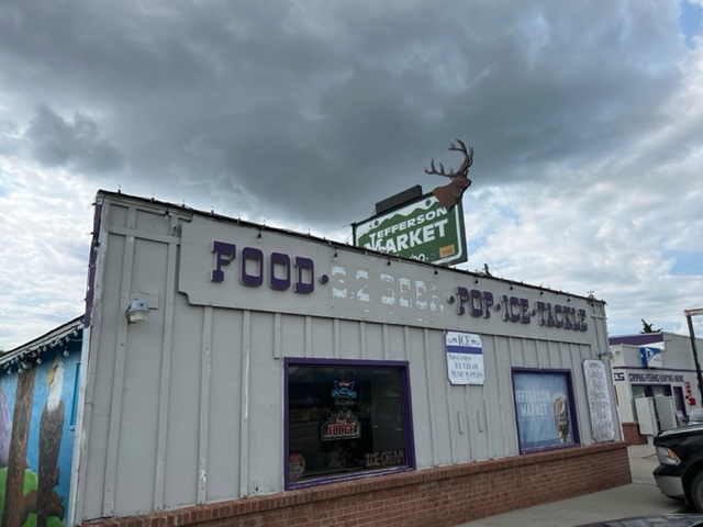
TRAIL NOTE: The town of Jefferson is a few short miles from Kenosha Pass. The Jefferson Market makes some of the best fudge around. It was so good we had to go back for more before we left the area. In the winter they will ship it to you. They also have a grill that turns out some tasty breakfast and lunch – anyone like BLT’s?

We met up with the traveler for lunch at Copper Mountain on August 1. Completing segments six and seven was big, as in vertical. And steep! Six takes you to 11,838 feet while seven tips up the grade and carries you to 12,495 feet as you crest the ridge of the Tenmile Range. Then it drops you to 9820 feet. Oh, my aching body!

Lunch was a fine reunion and then off she went to conquer segment eight at 24.4 miles with an elevation gain of 4417 feet with a loss of 3810 feet. We’ll see her at Tennessee Pass on August 2.


Photos from the traveler:


Kenosha Pass Signals the End of Segment Five


She’s traveled 71.7 miles since we bid her farewell on July 25. Sun, rain, thunder, and lightening have joined her along the four days of the first five segments of this challenging journey and she is a day ahead of schedule.  She reached nearly 11,000 feet and hiked through the Lone Creek Wilderness Area, a 119,790-acre wilderness established in 1980. According to the Colorado Trail Foundation the last native bison was killed here in 1897

We had just set up our camp when she wandered into our site. The Kenosha Pass Campground is part of the Pike-San Isabel National Forest and is located on the Colorado Trail making this resupply very convenient. Her feet were aching, and she was tired but after 70 plus miles that was expected. And she was hungry! We pulled out food fast – sausage, crackers, fruit, cheese, and a beer!

Her pup Tallus was overjoyed seeing “mom” come into camp, jumping for joy at the sight of her. After a good night sleep in the Pod she was ready to pack up and move on. The next segment travel into the high country reaching close to 12,000 feet in the first segment from Kenosha to Gold Hill.


Trail Notes: We stayed in site 14 at Kenosha West and loved it. There’s was lots of privacy and it was further away from road then the rest of the sites.